Showing posts with label article. Show all posts

Wednesday, July 8, 2009

Groningen - The World's Cycling City

This article is a repost from my friends over at the World Carfree Network. The article was written by by Ton Daggers and Jane Harding.

In Groningen, the Netherlands’sixth largest city, the main form of transport is the bicycle. The city is famous for having the highest percentage of bicycle usage in the world. How has Groningen done it? Cycling here, and indeed in much of the Netherlands, is just the norm. The success comes from a series of sound policies which view cycling as an integral part of urban renewal, planning and transport strategy. By providing proper infrastructure and amenities cycling has blossomed over time and today the main 46 routes of the cycling network is used daily by 216,000 citizens. By prioritising and promoting cycling as the main mode of transportation, city planners, local authori-ties and cycling advocates have played an important part in the city’s reputation as a great place to live. Groningen has a relatively young population of approximately 180,000 inhabitants, which account for a large proportion of the city bikers, but people of all ages opting for two wheels over four. And this is a growing trend. Research by Groningen municipality in 2008 showed a considerable growth of cycling in the last years: an average of 1.4 bicycle trips per person per day in the city, making up more than 50% of the total journeys, a growth of 9% from 2007. In order to further understand the sucess of the bicycle in Groningen, it is important to look at how urban design and policies have changed over time to make it the leading cycle city we see today.

“Cycling is viewed as an integral part of urban renewal, planning and transport strategy”
History of Carfree Development
The city has a long history of urban developments which have maintained the value of keeping the inner city as a central point for a host of activities: a blend of living, working and shopping which favours pedestrians, cyclists and public transportation over the car. Since the 1960s the municipality has been way ahead in its traffic plans and spatial planning policies; maintaining a vision of a “compact city”and implementing policies which have led to a carfree city centre, with almost all areas easily reachable by bicycle. However, the path has not always been easy.  During the 1950s and 1960s most cities and towns in the Netherlands were making room for vechicles – some even removed bicycle paths in order to free up space for the car.  In Groningen, motorisation was growing rapidly and so was suburban sprawl – there were no restrictions for cars driving through and very few cycle routes leading to the centre. The motorist was king at this time.In 1972, local authorities changed the emphasis of urban planning and development in Groningen.  The centre of the city was to be considered as the “living room”for its people. The basic concept used in urban planning was based on the “compact city”vision, which placed an integrated transport system high on the agenda – for an inner city favouring a combined use of pedestrians, cyclists, buses and other means of public transport. A traffic circulation plan divided the inner city into four sections and a ring road was built, encircling the city and reducing access to the centre by car. The result was an inner city which is entirely closed off to cars, and only possible to travel between sectors by walking, bicycling or using public transport. What has further spurred the use of bicycles over all other sustainable transportation is the huge expansion of the cycle network – there are many traffic free bike lanes from the outskirts to the city centre – making cycling is the most viable mode of transport for most journeys.

Importance of policy
The city treats cyclists with respect. A series of sound transportation policies and invest-ments has maintained a carfree urban space – favouring walking, public transport and predominantly cycling. This has resulted in a major trend away from car-use to bike-use in the city of Groningen. Between 1989 and 2000, € 23 million was invested in cycling infrastructure and the annual amount con-tinues to grow. Investments have also been made to expand the network of cycling lanes, improve the pavements, build bridges for cyclists, and many more bike parking facilities – making cycling faster and more convenient. As cycling is the lifeblood of the city, it has been given adequate space and time to flow safely and efficiently.

During the 1980s and 1990s a car parking policy was strictly implemented. Car parking with time restrictions was introduced in a broad radius around the inner city. Park and Ride areas were created combined with city buses and other high quality public transport. But overall, cycling policy has been central to the traffic plans, which in contrast, car accessibility has been restricted within the city centre.Reaping the RewardsOver a long period of time local authorities have made clear choices, however manifold criticised. Traffic circulation plans were based on the concentration of motorised traffic into a limited road space on the outskirts of the city, and developing a very coherent, comfortable and dense cycle network. This is the result of a clear vision of urban development – based on the idea that a city is for its people. Groningen is a compact city, and for now at least, continues to stay this way. For example, newly built neighbourhoods are no more than 6 km from the city centre. Groningen municipality research showed in 2008 78% of residents and 90% of employees now live within 3 km of the city centre. Residential areas are developed with good connections to the city centre and green lungs in between. There are entire housing developments built along major bicycle and scooter “roadways”, massive bike parks everywhere, many roads that are one way for cars but two way for bikes, and special signal phases for bikes.


Groningen in Numbers
Population: 180,000 inhabitants
Size of Groningen: 87 square kilometres
Residents Traveling by Bike: 57%
Average cycling trips each day: 1.4 per person
Number of cycling routes in Groningen: 46
Number using cycling routes each day: 216,000


There are some interesting economic repercussions to come out of replacing space for cars with greenery, pedestrianisation, cycleways and bus lanes. Banning car traffic has boosted jobs and business. Groningen’s economic development has improved, particularly for businesses which were once in revolt against car restraint, but now are clamouring for more of it. The main function of the inner city has become a successful mix of living, working and shopping.
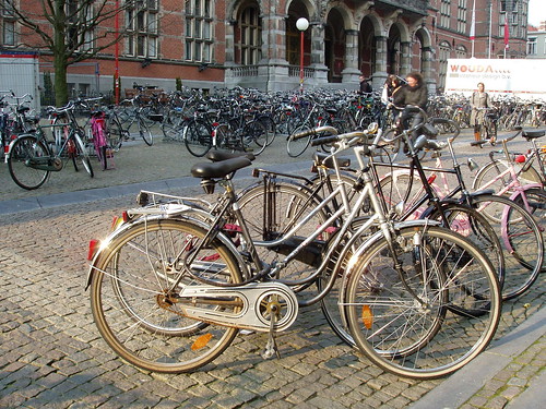
Cycling into the Future Groningen undoubtedly leads the way in the “cyclisation”of European cities, but many others are putting two wheels in motion to follow its example. However, no other European city can match Groningen’s record, where 57% of all trips around the city are on bikes, but in quite a few cities the ratio is rising to a third or more.The impressive high rate of cycling in Groningen can be explained best by consistent urban development and transportation policies based on reclaiming inner city space from cars, making it into a living room for its people. This spatial concept of city develop-ment has undoubtedly been rooted in the clear political vision of the Social Democrats for several decades. Such legislative commitments do seem to be the key in getting citizens to kick the car habit. Apart from a political vision, many other actors involved in making Groningen the “World’s Cycling City”cannot be ignored – the cyclists themselves. In a nutshell, the success of cycling in Gron-ingen can be explained as a result of a strong vision for a liveable city for its people.  For more information, please visit: http://www.cyclinginfo.nl/ and http://www.fietsberaad.nl/
The centre of the city was to be considered as the ‘living room’for its people”
Photo courtesy of  http://www.flickr.com/photos/truusbobjantoo/2404090966/

Monday, May 25, 2009

In Memory of Paul Benabides, 20

In was only just over a week ago, Saturday, that Paul Benabides was killed in a car "accident" near my house. This morning I went to go find any evidence, of the spot where he was tragically killed. I though I might spots flyers, posters, flowers, or candles. Since the newspaper report listed only Lois Ave., which runs North/South for about a mile, I peddled through the neiborhood slowly trying to find something that would remind neigbors ofthe tragic incident.

Peddling at a slow 5 mph I found no evidence of any accident.

Paul Benabides RIP
August 10, 1988 - May 15, 2009

Wednesday, May 13, 2009

Is This The End Of The (Suburban) World As We Know It?


Notice to Residents of Victorville - "Your Home May be Worth Less Than Your SUV"

As a follow up to my last post this morning (Is This The End ExUrbia as We Know It?). I went back to check on some of the other "possible unfinished developments" that Guaranty Bank, (currently at 64 cents a share - GFG) or any other bank may own. I had to stop because my eyes and hands were tired from clicking. If you think this real estate thing is over, you may want to think again.

Someone borrowed money from Guaranty, or B of A, or Chase/WAMU to pull the building permits and get the heavy machinery to start construction. Somebody lent on the hundreds of empty pads that dot the high desert. I'll tell you one thing; the bank presidents - they aint living in Victorville.

See Zillow Graph (You may have to scroll down)

Los Angles Times - "Housing Crunch Becomes Literal in Victorville"

Each Pin Represents a New Development in Victorville; a city of 100,000


View Victorville Real Estate in a larger map

Is This The End ExUrbia as We Know It?


Partially completed Southern California housing tract demolished

Original Article in the Daily Press Los Angeles Times - Article "Housing crunch becomes literal in Victorville"

In a story Associated Press article syndicated by the San Jose Mercury News, the demolition of the remaining partially constructed was noted. The article desribed the site as follows:
"The planned 16-unit tract on the fringes of a suburb about 65 miles northeast of Los Angeles included four finished homes with granite counter tops, whirlpool bathtubs and dual-pane windows."
Two things worth noting about the above statement. "Fringes of Suburb" is an understatement. Victorville is over 80 miles from downtown Los Angeles. According to Google Maps the drive to Victorville is over 80 miles which theoretically takes over 1 hour and 20 minutes and up to 2 hours, 40 minutes in traffic. Also to get to Victorville you would need to drive over a 4,200 foot high pass through the San Gabriel and San Bernadino Mountains. On some of the worst commutes; the trip could take over 5 hours, round trip.

Notice that the article described the homes with granite counter tops and whirlpool bathtubs, a classic add on at the hight of the real estate bubble.

Victorville is classic suburban type development gone wild and gets my Golden Asphalt Award . The gobbling up of desert land is clear noticeable from "the air" as you view the city on Google Maps . With only a 2007 population of just over 100,000 it has hit the suburban big time with their own mega mall, creatively called "The Mall" (I'm not making this up) featuring stores such as Sears, McDonalds, and Starbucks.

If you want to buy land next to this mall its only $7 million.


Tuesday, May 12, 2009

Vauban - Realistic Experiment?

Yesterday's New York Times reported on a town in southwestern Germany, nestled between the French and Swiss borders that has made a civic commitment to go car-free or more realistically as car-lite as possible. Titled "In German Suburb, Life Goes On Without Cars", the article (along with photos) describes a suburb of Frielberg, Germany (Google - My Maps). The Times also featured a discussion page about going "Carfree in America?".

Comparing Sunnyvale to Vauban

After reading the article take a look at the pictures that I have linked above and also my map created on Google Maps to get an idea of the scope of the car-free village. I am always curious the amount of land devoted to roadway. In a previous blog post I took a look at a corner of Sunnyvale, California (which due to the square mile grid pattern makes it a little fun and easy). In that post I estimated that this purely residential area devotes about 20% of its land area to road way (not counting the concrete used for driveways on private lots). In Vauban I calculated that less than 4% is used for auto roadways!

Here are some additional links on Vauban
Bike Portland - "Germany's Car Conscious Community"
The Christian Science Monitor - "New German Community Models Car-Free Living"

Also this article is linked to in the New York Times article - "Students Give Up Wheels For Their Own Two Feet"


Vauban Photo courtesy of Ecofaubourg at Fickr


View Vauban in a larger map

Saturday, May 9, 2009

Santa Clara County Sheriff Pleads Guilty in the Death of Two Cyclists


Sentencing Set for June 25

Deputy James "Tommy" Council pleaded guilty yesterday (May 8, 2009) in the deaths of two local cyclists Matt Peterson and Kristianna Gough. 

Sunday, April 26, 2009

Another Hit and Run On a Pedestrian...This One a 4 Year Old


Hit-and-run driver kills 4-year-old girl playing in driveway

Currently reasearching the number and trend of hit and run accidents relating to cyclists and pedestrians.  Absolutely senseless, any way you look at it.

Monday, March 16, 2009

Car Wash for Car Crash Victims

This isn't the first time I have seen car washes held to raise funds for car crash victim's. The article states that the young victims loved cars, only to die in a car.
Friends, family pitch in to aid young San Jose crash victims-San Jose Mercury News

with permission from A. Singer

Monday, November 10, 2008

All bike routes lead to SLO

All bike routes lead to SLO
Kylie Mendonca

San Luis Obispo cyclists got some good news from the City Council on Tuesday, with the approval of two bike-friendly traffic projects.

Funding to complete the Bill Roalman Bike Boulevard, which runs the length of Morro Street between Upham and Marsh streets, was approved after dozens of cyclists and neighbors showed their support for the project. It will cost the city an estimated $436,000, of which more than half is to cover the cost of scheduled maintenance.

Although the money for the project had already been allocated, the city has had to reconsider many projects in the city in light of a worsening budget outlook. Council members considered cutting certain safety and ornamental features, such as “bulb-out” curbs at the Pismo Street crossing, and a roadblock at Leff Street. Ultimately, however, the council passed the total project with a 5-0 vote. When it is completed, the boulevard will be closed to cars, except to allow them to cross the boulevard and to allow access to arterial streets.

Bike Coalition Executive Director Adam Fukushima said the strong show of biker support for the path led to its approval.

The Bike Boulevard is just one of several trails that will someday link-up and connect Cal Poly to the south side of town and the downtown area, as well as the Bob Jones Trail to Avila Beach.

Earlier this year, the city opened up a portion of the Bob Jones Trail, a sort of disconnected but beautiful path, which begins at Prado Road and winds around the back of SLO’s water reclamation facility before dead-ending at Highway 101 near Los Osos Valley Road. The council approved plans to build an overpass at that site, and many cyclists hoped that it would also include an underpass for bikes and pedestrians to access the path from Los Osos Valley Road. It didn’t, but the council did approve 12-foot-wide sidewalks, which can accommodate bike lanes in the future.

The Land Conservancy, a nonprofit organization devoted to preserving green space, hopes to connect the newest section of the trail to the historic Octagon Barn on South Higuera. The eventual goal is to connect the trail all the way to Avila Beach. Land Conservancy Executive Director Brian Stark said that while money is an issue right now, he was optimistic about the eventual completion.

“When the Bob Jones Trail is finally finished,” Stark said, “and bikes can get from downtown to Avila without having to get on a road, it’s going to be a priceless experience.”

For now, priceless seems a little steep for county and city budgets.

Monday, November 3, 2008

Girl, 11, killed in crash outside Glendale middle school

Girl, 11, killed in crash outside Glendale middle school

Glendale memorial
Anne Cusack / Los Angeles Times
Lia Catarinicchia, left, and Margaret Hall grieve at a memorial for Meri Nalbandyan, 11, a sixth-grader at Eleanor J. Toll Middle School in Glendale, who was killed by a sport utility vehicle in the crosswalk in front of school. Catarinicchia has a senior at nearby Hoover High and Hall is a PTA mother at Toll.
Meri Nalbandyan was hit in crosswalk in front of Eleanor J. Toll Middle School. Glendale police say a driver dropping off her child was looking in the wrong direction.
It's every parent's nightmare," said one mother still shaken by the sight of 11-year-old Meri Nalbandyan lying dead on the street outside Eleanor J. Toll Middle School. "What if it were my child? I'd go crazy."

Questions came more easily than answers -- even to the police investigating the driver, a mother who had just dropped off her own child.

"How come the student didn't stop or get out of the way or see the car coming," asked Glendale Police Sgt. Tom Lorenz. "As fate would have it, she too was looking in the wrong direction."

Through a cousin, Meri's parents said they were devastated.

Her mother, Lilit, dropped Meri off at school moments before the accident. She called her daughter "an angel."

Meri's father, Grigor, has returned repeatedly to the crosswalk where the eldest of the family's two daughters lighted candles and lay flowers.

"When we remember Meri, we envision a bright, luminous smile covering her face. She was the embodiment of innocence and purity for us. Now we drown in tears of sorrow," her family said in a statement.

Inside the foyer of the school, Meri's classmates -- some in tears -- scribbled notes on a large, pink poster.

"Dear Meri, you are and always will be my best friend," one girl wrote. "We ♥ u so much. I hope you are watching us in heaven!"

The first poster was already so full by midmorning that another blank board had to be added.

Principal Paula Nelson said Meri's death was a reminder to parents "to slow down, leave 15 minutes earlier and stop."

She said parents should "be defensive drivers and tell their children to be defensive walkers."

After Meri was hit about 8 a.m. by a sport utility vehicle, she was taken to Glendale Adventist Hospital, where she was pronounced dead.

A number of children witnessed the accident, but Nelson said she wasn't sure how many.

She said more than 20 children have met with grief counselors.

All classes spent first period talking about the accident, with students sharing their thoughts. Sixth-graders wrote essays about Meri and drew pictures.

Nelson remembered how excited Meri was to be starting middle school and how enthusiastically she participated in lunchtime activities, such as balloon tosses.

"It was so devastating to me," the principal said. "She was a wonderful bright spot."

 
The crosswalk where Meri was killed is on Glenwood Road, between the middle school and Herbert Hoover High School, and near Mark Keppel Elementary School.

The Glendale Police Department, which is investigating the accident, said the 38-year-old driver of the SUV was looking away from the crosswalk and driving about 10 mph when she hit Meri.

The driver, who was extremely distressed when she realized what happened, has been cooperating with investigators and was not taken into custody, Lorenz said.

Meri was the third pedestrian killed this year in Glendale. Officials said they knew of no recent accidents at that particular crosswalk. But at least two other pedestrians have been injured by cars several blocks to the east and west on Glenwood Road since 1997, a statewide traffic database shows.

The city provides crossing guards for major intersections around schools, but there was no guard at Meri's crosswalk Wednesday because it is in the middle of the block, Lorenz said.

At the crosswalk Thursday morning, an extra crossing guard helped manage traffic. Near the collection of flowers and candles that sprang up as a memorial, a cluster of parents spoke with concern about the erratic way some parents drive down Glenwood.

Debbie Miller said her two daughters, who are in the fourth and sixth grades, were so frightened by the incident that they spent the night in her bed.

She said parents often double-park as they let their children out in the street, and she often sees drivers impatiently zoom around stopped cars.

"They cause a lot of problems," she said. "I'm . . . surprised it didn't come up earlier."

Some students left notes in crayon or hastily written poems at the memorial. A teacher who had rushed to Meri to try to stop the bleeding taped a card emblazoned with a lion to the memorial:

"Hi Meri, you don't know me but I'm the teacher from Hoover High that tried to help you at the accident. I tried really hard to save you. I wish you peace and your family comfort at this time."

Sunday, November 2, 2008

Beyond the automobile: The road to sustainability has lanes for more than just cars

Transportation is the linchpin of sustainability. Fix the transportation system, and almost every other aspect of the city's ecological health improves: public health, conservation of resources, climate change, economics, and maintaining our culture and sense of community.

The region's unsustainable transportation system is the biggest cause of global warming (more than half the Bay Area's greenhouse gas emissions come from vehicles) and one of the biggest recipients of taxpayer money. And right now, most of those public funds are going to expand and maintain freeway systems, a priority that exacerbates our problems and delays the inevitable day of reckoning.

It's going to have to change — and we can do it the easy way or the hard way.


"We'll get to a more sustainable transportation system. The question is, are we going to be smart enough to make quality of life for people high within that sustainable transportation system?" said Dave Snyder, who revived the San Francisco Bicycle Coalition and founded Transportation for a Livable City (now known as Livable City) before becoming transportation policy director for the San Francisco Planning and Urban Research Association. "People will drive less, but will they have dignified alternatives? That's the question."

That notion — that transportation sustainability is inevitable, but that it'll be painful if we don't start now in a deliberate way — was shared by all 10 transportation experts recently interviewed by theGuardian. And most agreed that needed reform involves shifting resources away from the automobile infrastructure, which is already crowding out more sustainable options and will gobble up an even bigger piece of the pie in the future if we continue to expand it.

"Yeah, it'll be more sustainable, but will it be just? Will it be healthful? Will it be effective? Those are the questions," said Tom Radulovich, director of Livable City and an elected member of the BART Board of Directors. "You can't argue against geology. The planet is running out of oil. We're going to have a more sustainable transportation system in the future. That's a given. The question is, is it going to meet our other needs? Is it going to be what we need it to be?"

And the answer to all those questions is going to be no — as long as politicians choose to fund wasteful projects such as a fourth bore in the Caldecott Tunnel and transferring $4 billion from transit agencies to close California budget deficits accruing since 2000.

"Our leaders need to be putting our money when our collective mouth is and stop raiding these funds," Carli Paine, transportation program director for Transportation and Land Use Coalition, told us. "I'm hopeful, but I think we all need to do more."

TRANSIT AND BIKES

There is reason to be hopeful. With increased awareness of global warming and high gasoline prices, public transit ridership has increased significantly in the Bay Area. And one study indicates that the number of people bicycling in San Francisco has quadrupled in the last few years.

"Look at what's happening on the streets of San Francisco: you have biking practically doubling every year without any new bike infrastructure. I think the demand is out there. The question is, when is the political leadership going to catch up to demand?" Jean Fraser, who sits on the SPUR and SFBC boards and until recently ran the San Francisco Health Plan under Mayor Gavin Newsom, told us.

But the political leadership and federal transportation spending priorities are behind the times. Of the $835 million in federal funds administered by the Metropolitan Transportation Commission for the nine Bay Area counties in 2006-07, 51.4 percent went to maintain and expand state highways. Only 2.5 percent went for expansion of public transit, and 2.4 percent for bike and pedestrian projects. Overall, Paine said, about 80 percent of all transportation funding goes to facilities for automobiles, leaving all modes of transportation to fight for the rest.

"Historically we favor the automobile at the expense of all those other modes," Radulovich said at a forum of experts assembled by the Guardian (a recording of the discussion is available at sfbg.com). "It's been given primacy, and I think everyone around this table is saying, in one way or another, that we need a more balanced approach. We need a more sustainable, sensible, and just way of allocating space on our roads."

Yet the Bay Area is now locking in those wasteful patterns of the past with plans for about $6 billion in highway expansions, which means the MTC will have to spend even more every year keeping those roads in shape. Highway maintenance is the biggest line item in the MTC budget, at $275 million.

"We can't pay for what we have now — to maintain it, repair it, seismically retrofit it — so why we're building more is kind of beyond me," Radulovich said. "We continue to invest in the wrong things."

The experts also question big-ticket transit items such as the Central Subway project, a 1.7-mile link from SoMa to Chinatown that will cost an estimated $1.4 billion to build and about $4 million per year to run.

"There are 300 small capital projects we need to see," Snyder said. "That's really the answer. The idea of a few big capital projects as the answer to our problems is our problem. What we really need are 100 new bike lanes. We need 500 new bus bulbs. We need 300 new buses. It's not the big sexy project, but 300 small projects."

The most cost-efficient, environmentally effective transportation projects, according to renowned urban design thinkers such as Jan Gehl from Denmark, are those that encourage walking or riding a bike.

"I think Jan Gehl put it best, which is to say a city that is sweet to pedestrians and sweet to bicyclists is going to be a sustainable city," Fraser said. "So I think focusing on those two particular modes of transportation meets the other goals of the financial viability because they're the cheapest ways to get people around — and the healthiest ways — which I submit is one of the other criteria for sustainable transportation.... And it helps with the social justice and social connections."

IT'S GOOD FOR YOU

In fact, transportation sustainability has far-reaching implications for communities such as San Francisco.

"I think of sustainability in two ways," Fraser said. "The first is sustainability for the environment. And since I have a background in health care, I think of a sustainable transportation system as one that's actually healthy for us. In the past at least 50 years, we've actually engineered any kind of active transportation — walking to work or to school, biking to school — out of our cities."

But it can be engineered back into the system with land use policies that encourage more density around transit corridors and economic policies that promote the creation of neighborhood-serving commercial development.

"If my day-to-day needs can be met by walking, I don't put pressure on the transportation system," Manish Champsee, a Mission District resident who heads the group Walk SF, told us.

The transportation system can either promote that sense of community or it can detract from it. Champsee said San Francisco needs more traffic-calming measures, citing the 32 pedestrian deaths in San Francisco last year.

Almost a third as many people are killed in car accidents as die from homicides in San Francisco — but murder gets more resources and attention.

"There's a real sense in the neighborhoods that the roadways and streetscapes are not part of the neighborhood, they're not even what links one neighborhood to another. They're sort of this other system that cuts through neighborhoods," said Gillian Gillette of the group CC Puede, which promotes safety improvements on Cesar Chavez Street.

Radulovich notes that streets are social spaces and that decisions about how to use public spaces are critical to achieving sustainability.

"A sustainable transportation system is one that allows you to connect to other people," he said. "Cities have always thrived on connections between humans, and I think some of the transportation choices we've made, with reliance on the automobile, have begun to sever a lot of human connections. So you've got to think about whether it's socially sustainable. Also economically sustainable, or fiscally sustainable, because we just can't pay for what we have."

So then what do we do? The first step will take place next year when Congress is scheduled to reauthorize federal transportation spending and policies, presenting an opportunity that only comes once every four years. Transportation advocates from around the country are already gearing up for the fight.

"We've built out the freeways. They're connecting the cities — they're pretty much done. So what do we need to do to make streets more vibrant and have more space for people and not just automobiles?" asked Jeff Wood, program associate for the nonprofit group Reconnecting America and the Center for Transit-Oriented Development.

Then, once communities such as San Francisco have more money and more flexibility on how to spend it, they can get to work on the other sustainability needs. "The key component is having all the transportation systems fully linked," Paine said. That means coordinating the Bay Area's 26 transit agencies; expanding on the new TransLink system to make buying tickets cheaper and easier; funding missing links such as connecting Caltrain from its terminus at King and Fourth streets to the new Transbay Terminal; and timing transfers so passengers aren't wasting time waiting for connections.

And the one big-ticket transportation project supported by all the experts we consulted is high-speed rail, which goes before voters Nov. 4 as Proposition 1A. Not only is the project essential for facilitating trips between San Francisco and Los Angeles, it takes riders to the very core of the cities without their having to use roadways.

Paine also notes that the bond measure provides $995 million for regional rail improvements, with much of that going to the Bay Area. And that's just the beginning of the resources that could be made available simply by flipping our transportation priorities and recognizing that the system needs to better accommodate all modes of getting around.

At the roundtable, I asked the group how much a reduction in automobile traffic we need to see in San Francisco 20 years from now to become sustainable — with safe streets for cyclists and pedestrians, free-flowing public transit, and vibrant public spaces.