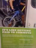
Just recorded my second trip using the new REI "
Bike Your Drive" app. Technically this app is nice from a couple of standpoints; the ability to take photos along the way using your iPhone and the ability to use your iPhone as a GPS bike computer.
The actuall operation is pretty straightforward. Open the app to the dashboard screen which displays speed, distance, etc., (see screenshot at left) hit the start button and your ready to go. There is a feature to lock the screen, (the button in the lower right portion of the screen) so if your like me and just stick it in your pocket you dont have to worry about the ride being aborted inadvertantly. I am not sure but I am looking to see if there are any iPhone bike mounts available but you can probably make one withuout any effort.
One of the best features of this app is the ability to take geo-locatable photos while your riding (button in the lower left portion of the screen). Very Cool.!
After your ride hit the stop button in the middle and it will prompt you if you want to save or

resume the ride. If you decide to end the ride right there you can save the ride to a draft ride file or upload it.
If you save the file it will prompt you for a name (required) and a ride story if you would like to add comments. There is also a photo button to edit your photos (include:default, or keep and attach an caption).
Once your ready to upload just hit the upload button and you will be taken to a screen that shows you the upload progress. First the file will be converted to GSX a GPS type of XML, then the photos will loaded given you the progress of each photo such as "Photo #1 of #5". Obviously the more photos the more upload time so if you have more than 5 photos you may want to establish a WiFi connection first.
One other nice feature of the app itself (before moving to the next stage, everytrail.com) is the fact that you can describe the type of activity; road biking, nordic skiing, train, walking, etc. This app naturally defaults to the road biking activity.
EveryTrail.comThe other component to this app is the upload side of "Bike Your Drive". This app connects you to everytrail.com. You can view your trip via their site or embed the trip in your site or blog as I have done here. You can even get the
same look and feel with routes and photo markers in Google Earth which is really nice. According to the sites
blog recorded trips (using other types of GPS input of course) has reached over 100,000 publicly available trips.
Whats nice about the everytrail site is that you can browse trips by country, state and county. Currently there are 8,500 public trips for
California. By clicking on the "
World Map" Section of the top menu bar you can choose from over 25 different activities based on its world map location. Some of the more obscure are sightseeing, hangliding/paragliding, and skateboarding..
So in a nutshell here are the Goods and Not So Goods.
Goods
- Very simple and easy to use.
- Free App
- Taking Photos along the way is way cool.
- The abilitity to lock the app along the way.
- The ability to set the accuracy of the GPS to optimize battery life.
Not So Goods
- Screen is a shade of green with a white font which is very difficult to read in the bright California summer sun. It would be great if you had an option to change the screen background to black.
- Also the dashboard cold be a little more readable.
- I've used the app three times already and couldn't get the cummulative stats to work even though I have input my weight, cost of gasoline, and MPG.
All in all I thing this is a great app and its FREE and its use is not just limited to cycling, it would also be great as a photo log of tours, sightseing, hiking, etc.
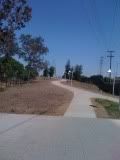
Whole Foods Cupertino to Peets Saratoga at EveryTrailMap created by EveryTrail:
Geotagging CommunityNote: Author is an employee of REI


 type of organized ride where fun, socializing and some type of light physical activity happen while feeling connected to a larger group of riders. As you enter the street at the start of the ride and feel more confortable riding amongst cars; that on any given day treat you as just a road obstacle, it feels good to be with fellow riders enjoying the warm summer evening.
 resume the ride. If you decide to end the ride right there you can save the ride to a draft ride file or upload it.